

Sorry if this isn't the right place to post, but I didn't know where it would be most appropriate ...
Well, I found this great article about Tolkien and cartography which corrects some common (essentially topographical) misconceptions, but, unfortunately it's in French, so I suppose most of you won't be able to read it, but I figured I could translate the most important informations for a project like MCME .
.
-> The Great East Road going through Trollshaws goes between two surface elevations, one of which covers the Angle entirely.
-> Dol Guldur is the highest point of a moutain mass at the extreme south of Mirkwood.
-> Barrow-downs extend North of the Old Forest.
-> Harlindon is higher than Forlindon, which forms a non wooded plateau.
-> The Brown Lands present reliefs forming a vast Northeast extension to Emyn Muil.
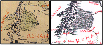
-> Fangorn actually grows entirely on the foothills of Misty Moutains rather than on +/- flat terrain. There's a large extension of the Misty Moutains there, making Fangorn actually a moutain flank forest!
Actually, most of the maps analyzed by the article come from this book: http://www.thelandofshadow.com/sneak-peek-into-the-art-of-the-lord-of-the-rings. You can see photos in the link, but not of very high resolution. My article presents this zoom, though:
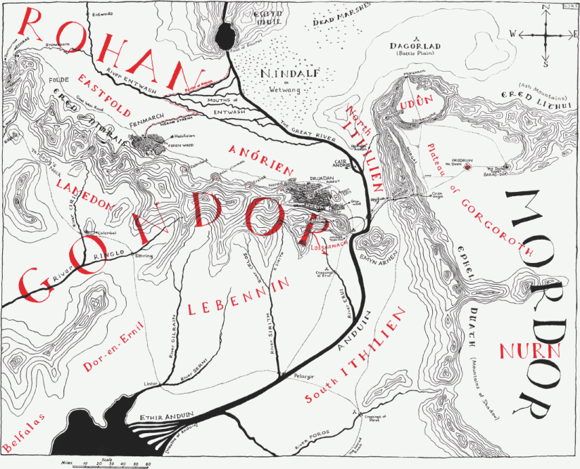
Ther's also this redrawn of the Gondor - Mordor map, but it's more known (and the area almost finished):
Well, I found this great article about Tolkien and cartography which corrects some common (essentially topographical) misconceptions, but, unfortunately it's in French, so I suppose most of you won't be able to read it, but I figured I could translate the most important informations for a project like MCME
.-> The Great East Road going through Trollshaws goes between two surface elevations, one of which covers the Angle entirely.
-> Dol Guldur is the highest point of a moutain mass at the extreme south of Mirkwood.
-> Barrow-downs extend North of the Old Forest.
-> Harlindon is higher than Forlindon, which forms a non wooded plateau.
-> The Brown Lands present reliefs forming a vast Northeast extension to Emyn Muil.
-> Fangorn actually grows entirely on the foothills of Misty Moutains rather than on +/- flat terrain. There's a large extension of the Misty Moutains there, making Fangorn actually a moutain flank forest!
Actually, most of the maps analyzed by the article come from this book: http://www.thelandofshadow.com/sneak-peek-into-the-art-of-the-lord-of-the-rings. You can see photos in the link, but not of very high resolution. My article presents this zoom, though:
Ther's also this redrawn of the Gondor - Mordor map, but it's more known (and the area almost finished):
Last edited:


