• Welcome to MCME!

    Minecraft Middle Earth is a Minecraft community that recreates the world described by JRR Tolkien and his writings. Everyone can participate in organized events in which we collaborate to create major landmarks, terrain, caves, castles, towns, farms and more.

    To get started, visit The New Player Guide

    Joining the server

    Joining the server can be done straight away, but you will have to pass the New Player Quiz. Use the The New Player Guide to get acquainted with our community.

    IP: build.mcmiddleearth.com

Finished Misty Mountains [Part 1 - Mountains of Moria]

maybe the main source could split into multipe 2-3 wide block falls that then rejoin at the bottom of the falls, that way the source would be realistic, in the volume of water and the 2-3 block width would make the falls seem taller
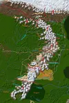
The source will be a big glacier, more water is joining from a side river that has two more glaciers as source.

Always thought nimrodel was just a small 2-3 block wide stream, since it was described as being fordable. Also, having it as a stream might allow nicer overall feelings, making the falls seem taller etc.
There are many rivers throughout middle-earth that have fords and arent small streams: Sarn Ford @ Brandywine, Bruinen Ford, Entford
The shape will (most likely) be 3 falls after each other; they dont have to look tall.
 
The thing is though, when you're actually in Minecraft, things that are just a few blocks across don't look quite as large as they do in real life. For instance, a 3x3 room in a building feels claustrophobic, when that would be a reasonable size for a bedroom in your actual house, give or take. Erring on the side of being wider is probably a good move from a visual standpoint.
 
Yea, but the books kind of made itout like it was a small stream fordable all along the stream. plus it calls it a stream if i remember correctly

To confirm, I dug out my own copy, and it is indeed called a stream whenever it is mentioned.

I won't lie that the width i used was coming from the river that was already given before; I didnt want to redo it wholly, cuz the last part before it enters Celebrant is really steep and for a bigger river a huge pain to make cause MC water is really weird and nasty to handle.
I agree with the argumentation of PD, and want to add that merely all other rivers on the map are clearly wider, among them also some that arent meant to be more than streams.
 
The main post outlines each of the parts (very well as Fin is inclined to emulate). After Moria Will be the area of mountains of Fangorn and Isengard.
 
Exactly, the next section will be between Rivendell and Redhorn Pass, so that the fellowships path can be completed.

Here's an updated overall map:
n18bc1.jpg
 

Attachments

  • n18bc1.jpg
    n18bc1.jpg
    285 KB · Views: 290
So...will the Gladden pass be in the same condition as the Redhorn, or a bit less maintained?

That is indeed a good question. The only knowledge given on the pass (afaik) is this quote from LotR; time: around december 3018 T.A.:
Many [elves] had gone east and south; and some of these had crossed the Mountains and entered Mirkwood, while others had climbed the pass at the source of the Gladden River, and had come down into Wilderland and over the Gladden Fields and so at length had reached the old home of Radagast at Rhosgobel.

So what does that mean? The answer is simple: We have to make up our own story for that pass, and I have one:
Facts:
At around 2450 T.A. Orcs began to occupy Moria (which was since 1980 held solely by the Balrog); in 2509 T.A. Celebrían, Elronds wife, gets waylaid on the Redhorn pass by orcs.
Story:
Elrond and Galadriel decide that they need a more or less safe possibility to travel from Rivendell to Lothlórien. The solution is a new secret pass - the gladden pass. I also decided to add a (older) road along the Anduin, connecting Loth, the High pass and the Men-i-Naugrim, and thus also the Gladden pass.
For that the design of the gladden pass road may be as followed: A rather quickly established road, without (m)any bridges and tunnels as the redhorn pass has, and probably steeper and harder to walk. But the general state may be good.
Now you may ask yourself (as many other people did): Why didnt the fellowship take the gladden pass then? Well, a simple possibility would be argueing that by 3018 T.A. that pass too was occupied by orcs and thus making it not much better than the redhorn pass; and the latter is the faster way. Another variable in the game may be Dol Guldur which was gaining strength from around 2500 onwards; an indice is that in 2841 Thrain II. was captured near Dol Guldur, thus it may have started to control the road I mentioned above (that road ultimatively connects Loth and the woodland realm).
 
Last edited:
After 210 days or 30 weeks I can close this first big part of the Misty Mountains revamp!

Thanks everyone who helped, staff that voxeled and artists and adventurers that built glaciers, dug rivers, placed bushes and so on...
Closed it all off with the biggest job i ever led, thanks everyone for joining!


To be continued...
By my calculations it will take approximately 4.6 years to finish the entire mountain chain at this rate.
 
Top